


Discover the best hiking routes in Andorra to do sport and enjoy nature. The country of the Pyrenees offers endless activities and mountain routes. Hiking lovers love to visit Andorra because of the number of routes on offer and the wonderful temperatures in summer. Of course, there are not only routes for the most experienced hikers, but there are excursions for all levels and tastes!
Hiking routes in Andorra
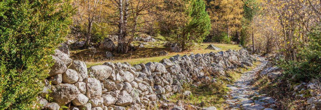
In Andorra there are many valleys and mountains reaching up to 3,000 metres and there are even 3 protected areas: the Madriu-Perafita-Claror Valley (UNESCO World Heritage Site), the Valls del Comapedrosa Communal Nature Reserve and the Sorteny Valley Nature Reserve. Ideal places for hiking in Andorra.
Engolasters Lake and the Pardines Trail
This mountain route is linear and consists of an excursion lasting almost 4 hours starting at the church of Sant Martí de Engolasters.
Near this location, at the Font de la Closa fountain, there is a picnic area. The route is not very complicated, but it is made more difficult by the slope and the distance to be covered, so, as always, you need to be well equipped!
The best thing about this hiking route are the panoramic views of the Casamanya peaks, the Estanyó and Cabaneta mountain ranges. In addition, it also crosses the botanical path of the Camino de las Pardines, where you can find red and black pines.
- Distance: 13.8 kilometres
- Level: Medium
- Estimated duration: 3 hours and 40 minutes
Abelletes Lake (Pas de la Casa)
This is a pleasant 4-kilometre route. If you are looking for an easy hiking route, this is the one for you. It is a route that families with children tend to do a lot. It is located between Andorra and France, so if you walk around the lake you will physically pass through both countries. Important, there are no shadows along the route.
- Distance: 4.71 kilometres
- Level: Moderate
- Estimated duration: 2 hours and 22 minutes
Iron Route or Ruta del Ferro
The Iron Route is also ideal for families. It passes through places of cultural and natural interest that offer a different way of exploring nature while hiking.
To start the route, park at the Llorts Mine and head towards La Cortinada. This linear route is notable for passing along the Camino de los Trajinantes, an old route used to transport iron. Nowadays, you can see the “Iron Men”, an open-air exhibition featuring iron sculptures that simulate the old route.
- Distance: 4.2 kilometres
- Level: Easy
- Estimated duration: more than 2 hours
Montmalús Peak and Colells Circus
For those who like more extreme hiking, Andorra offers this circular route that allows you to walk along the crest of the Colells cirque. The route starts in Grau Roig and climbs up to the peak of Montmalús.
What hikers highlight most about this route is the scenery, with large vertical rock walls and a number of lakes.
It is not an easy route, but it is well worth it. Along the way, you can see how the landscape changes and how nature tells the story of the passage of time.
- Distance: 10.4 kilometres
- Level: Difficult
- Estimated duration: 4 hours
Circular route through the parish of Canillo
Andorra’s hiking experts point out that the most characteristic feature of this route is the contrast between the slopes of the sunny side and the shady side. You will find the route signposted with coloured flower-shaped graffiti!
During this route, you will cross different valleys such as Montaup, Riu, Ransol and Incles on the way to Soldeu. Although it is not a difficult route, there is quite a steep slope and a long distance to cover.
- Distance: 29.4 kilometres
- Level: Remarkable
- Estimated duration: 9 hours
Estanyó Peak
The Estanyó peak is the second highest mountain in Andorra, at an altitude of 2,915 metres. It is located in the parish of Ordino and the route is 11.7 kilometres long, with a difference in altitude of 1,175 metres.
The route goes up from the Canya de la Rabassa car park in the Sorteny Valley Natural Park, along a track until taking a detour to the Estanyó valley, where there is a beautiful lake of glacial origin. This route does not present any technical difficulties and the paths are well signposted, but the slope is considerable and it is advisable to be in good shape.
- Distance: 11.87 kilometres
- Level: Moderate
- Estimated duration: 4 hours and 30 minutes
These are just some of the many hiking routes that Andorra has to offer. Are you up for discovering any of them?